Archive for In The News

The Cascadia Fault: An Inconvenient Truth

The Cascadia Fault: An Inconvenient Truth

The human and economic devastation of the coming West Coast earthquakes is unimaginable. Whether it’s the magnitude-9 Big One that strikes first, or smaller—but equally deadly—temblors, recovery will take years, not weeks. Almost half of small businesses will fail. Hundreds of thousands of British Columbians will leave and never return. But as with any inevitability, there’s money to be made before and after the Cascadia fault changes our lives forever.

Now. Or now. Next Thursday. Tomorrow while you sleep. One morning as you’re crossing the Alex Fraser Bridge or inching through the George Massey Tunnel, thinking about time and traffic and lunch options when suddenly the pavement shrugs and the earth begins its awful dance while stolid structures begin undulating like studies in a surrealist’s sketchbook. It’s the Big One. First you pray that you—and your family and friends—will be the lucky ones. Next you ask yourself if you’re prepared. But none of us are in this alone, and the general state of affairs after a major earthquake will depend on more than just your household emergency kit. It will also depend in part on the preparations of business and government.

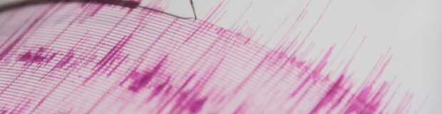
When? We’re better at predicting terrorist attacks than earthquakes, but don’t try telling that to the Italians. After an April 6, 2009, earthquake that killed 300 people in the Italian city of L’Aquila, seven scientists and engineers were convicted of manslaughter for their failure to properly warn residents. Like tribal shamen who fail to warn of catastrophe, they were sacrificed to that greatest of scientific uncertainties—the exact timing of our planet’s deadly tectonic adjustments.

The Cascadia fault—also known in more paranoid circles as the Cascadia Subduction Zone—runs offshore from somewhere near the top of Vancouver Island to northern California. Over the past five millennia it has ruptured with terrifying frequency. It will certainly rupture again, but this time with a string of 21st-century cities—high-rising, dense-with-people, globally interdependent regional capitals—stacked squarely in its impact zone.

One of the most recent probability surveys was done by the Oregon Seismic Safety Policy Advisory Commission. Based on comparisons with the 2011 Japanese quake and tsunami, the Oregon study predicts a massive Cascadia quake could kill 10,000 people and cause $32 billion in damage in an area ranging from Vancouver Island to Vancouver and down as far as northern California.
Most British Columbians are not ready. But at least they know it. An Angus Reid poll conducted last year showed 61 per cent of B.C. adults are concerned about being personally affected by an earthquake and fully 87 per cent believe a major quake is coming within 50 years. And yet 60 per cent admit that they do not have an emergency kit—70 per cent have no emergency plan.
Although seemingly negligent to Californians and the Japanese, B.C.’s indifference shouldn’t be that surprising, considering the example being set at the top. A 2006 study by Zeidler Partnership Architects commissioned by the provincial government (but never released until it was revealed in 2011 by reporter Stanley Tromp in the Tyee) stated that unless Victoria’s provincial legislature receives well over $200 million in seismic upgrades, it will very likely suffer major damage in a significant temblor, resulting in considerable loss of life. Whatever other damage it might cause, a major quake would probably cripple the provincial government for months.

Who is most at risk? We’re all supposed to be asking that question but the really motivated people are insurance companies. Around the world actuaries map out areas of relative risk, known in the industry as CRESTA zones (Catastrophe Risk Evaluating and Standardizing Target Accumulations, an unwieldy name reportedly created to match the Cresta Hotel in Davos, Switzerland, where the system was devised in the late ’70s). In Canada an industry group, the Institute for Catastrophic Loss Reduction (ICLR, not as yet a hotel name), created a Canadian actuarial map that ranks seismic risk for individual postal codes. Thirteen B.C. codes fall into the “Extreme” category—all located in Victoria, Delta and Richmond. V7B, the postal code for YVR Airport, is among those extreme risk areas. Think about that: an airport that handled 17.6 million people in 2012, the air-traffic entry point into Vancouver, might be rendered unusable for months at any moment. According to YVR’s own figures the airport contributes $1.9 billion to Canadian GDP annually (as well as employing 23,600 people). YVR spokesperson Alisa Gloag says that the facility is very focused on seismic concerns—“Parts of the original 1968 domestic terminal are currently undergoing seismic upgrades,” she points out—but she’s cautious about the potential for runway damage. “It all depends on magnitude and location,” Gloag says. “We have three runways, so if one was damaged, then we would be able to adjust our operations accordingly.”

It all depends, indeed.

Four more codes fall into the “Very High” category—V8N and V9B in Greater Victoria, V4L in Delta and V4R in Maple Ridge. Two Abbotsford codes (V2S and V2T) are ranked “High,” as are V7P (southwest North Vancouver), V8W (home to the provincial legislature) and V9A (containing the Canadian Forces base in Esquimalt), among others. The bulk of Vancouver and neighbouring regions—Burnaby, Surrey, Coquitlam, Port Coquitlam, etc.—rank as “Moderate” or “Low.” (This means moderate or low risk for this region—it does not mean that the quake damage risk in Vancouver is as low as that of, say, Regina.)…

Source: http://www.bcbusiness.ca/tech-science/the-cascadia-fault-an-inconvenient-truth

Posted in: In The News

Leave a Comment (0) →

Earthquake rattles northern Vancouver Island, no injuries

Earthquake rattles northern Vancouver Island, no injuries

A “moderate” quake shook the northern end of Vancouver Island early Sunday morning, waking many people in their beds as windows rattled and blinds swayed from the tremors.

Earthquakes Canada said the 5.5 magnitude quake hit at about 6:20 a.m. local time about 25 kilometres west of Nootka Island, off the north coast of Vancouver Island.

There were no reports of any damage or injuries, and no tsunami was expected.

“It woke up many people in communities on northern Vancouver Island,” said John Cassidy, an earthquake seismologist with Natural Resources Canada.

“Because the earthquake was far enough away it wasn’t strong enough to knock items off shelves or cause any damage but people certainly noticed five to 10 seconds of shaking where things were swaying back and forth.”

Vancouver Island communities that felt the quake included Port Alice, Port McNeill, Port Hardy, Tahsis, Sointula and Alert Bay.

Residents living in small communities on Nootka Island felt the quake as well.

The quake was caused by ocean plates rubbing together in a region known as the Nootka fault zone, said Cassidy.

“This is one of the seismic hotspots along the west coast,” he said.

“We tend to get a band of seismicity along the region where those two ocean plates meet, and that’s where today’s earthquake occurred, it’s a boundary between those two ocean plates.”

Although the early-morning quake didn’t cause any damage or injuries, it was a reminder of seismic activity in the area, said Cassidy.

“We live in a very active region. This is a direct result of plate movement,” he said. “We know that energy is being stored for

much larger earthquakes in the future…being prepared, knowing what to do, is really important.”

Earthquakes Canada said small aftershocks from the quake could be felt through Sunday.

During an earthquake, those inside a home or building are advised to drop down and crawl under strong furniture, cover their head and neck and stay away from windows and shelves with heavy objects.

If unable to go under something strong, crouching or flattening oneself against an interior wall is advised.

Those outdoors during an earthquake are advised to stay away from power lines, buildings and the shore. Those in vehicles are advised to pull over and stay inside.

Source: http://www.cbc.ca/news/canada/british-columbia/story/2013/08/04/vancouver-island-earthquake.html

Posted in: In The News

Leave a Comment (0) →

Earthquake hits Hardy, it’s a good reminder for you to be prepared

Earthquake hits Hardy, it’s a good reminder for you to be prepared

There was an earthquake 185 kilometres west of Port Hardy Thursday morning.

The quake registered 5.1 and according to the Natural Resources Canada’s online earthquake report, the shake-up occurred at 5:57 a.m. There are no reports of damage and no tsunami warnings were issued for the region.

With more than 1,200 recorded earthquakes every year in British Columbia it is becoming increasingly important not to ignore these incidents and to be prepared.

A new study says the Pacific coast has experienced 22 major earthquakes over the last 11,000 years, and is due for another.

Audrey Dallimore, of the School of Environment and Sustainability at Royal Roads University and the author of the study, said the research showed mega earthquakes occur every 500 to 1,000 years.

The last one took place 313 years ago. A megathrust earthquake occurs when a piece of the earth’s crust is forced underneath another plate.

The quakes are of magnitude 9.0 or greater, and both the 2004 Indian Ocean

earthquake that caused the tsunami in Indonesia and the 2011 earthquake and tsunami in Japan were megathrust events.

“We could have one either tomorrow – or 700 years from now,” said Dallimore.

The last “Big One” that we had in Canada happened in 1700 and measured a magnitude of 9.0. It destroyed Native villages and actually caused a tsunami in Japan.

The 1946 Vancouver Island earthquake, Canada’s largest recorded onshore earthquake to date, was a 7.3

magnitude earthquake that struck Vancouver Island at 10:15 a.m. on Sunday, June 23, 1948. The main shock epicenter occurred in the Forbidden Plateau area northwest of Courtenay and west of Campbell River It was felt as far away as Portland, Oregon. The earthquake knocked down 75 per cent of the chimneys in the closest communities, Cumberland, Union Bay, and Courtenay (including the Courtenay School) fortunately,

the earthquake occurred on a Sunday morning so no children were at their desks. A number of chimneys were shaken down in Victoria and people in Victoria and Vancouver were frightened, many running into the streets.

Because Vancouver Island is located directly on a fault line it is considered to be a high risk earthquake zones.

It is now more important than ever to be prepared for the big one, however putting together an earthquake kit can seem somewhat overwhelming; having the resources immediately at hand to deal with the emergency may make the difference of life or death or at the very least comfort or discomfort.

Source: http://www.canada.com/Earthquake+hits+Hardy+good+reminder+prepared/8728588/story.html

Posted in: In The News

Leave a Comment (0) →

Magnitude 5.0 earthquake recorded off B.C.’s west coast

Magnitude 5.0 earthquake recorded off B.C.’s west coast

Earthquakes Canada said no surge or tsunami was expected to reach shores after a small earthquake rattled the ocean off northwestern Vancouver Island early Friday morning.

Earthquakes Canada and the U.S. Geological Survey recorded the temblor at a magnitude of 5.0 when it hit, at 5:57 a.m. PT Friday morning under the Pacific Ocean, about 170 to 185 kilometres west of Port Hardy, B.C.

The U.S. West Coast and Alaska Tsunami Warning Center said the quake was not strong enough to generate a dangerous wave.

The shaker occurred in a region where earthquakes are common because of the movement of several plates of the earth’s crust.

Natural Resources Canada says more than 100 earthquakes of magnitude 5.0 or stronger have occurred off British Columbia in the last 70 years, including the magnitude 7.7 quake, the second strongest ever recorded in Canada, that jolted the west coast of Haida Gwaii last October.

After three hours, neither the USGS nor Earthquakes Canada’s online “felt” maps showed any reports from Friday morning’s quake.

Source: http://www.cbc.ca/news/technology/story/2013/07/26/bc-earthquake-ocean-vancouver-island.html

Posted in: In The News

Leave a Comment (0) →

Canadian quake refines Pacific tsunami risk

A study of the magnitude-7.7 earthquake that shook the northern coast of British Columbia, Canada, last October has solved a longstanding argument about the region’s geology. The finding suggests that even Pacific islands as far away as Hawaii might need to worry about tsunamis originating from this part of the Canadian coast.

Most of the tsunami threat in North America’s Pacific Northwest stems from the Cascadia fault, where the Juan de Fuca crustal plate dives beneath Washington, Oregon, and parts of California and British Columbia. The 2012 quake struck north of that region, where the Pacific crustal plate slides towards Alaska along a major geological fault known as the Queen Charlotte.

Many scientists had thought that this ‘strike–slip’ motion would not yield big tsunamis, because the two sides of the sea floor move along the horizontal axis, displacing less water than shifts upwards or downwards. But on 27 October 2012, the sea floor near the Haida Gwaii archipelago ruptured along a fault perpendicular to the Queen Charlotte fault. The quake shoved a chunk of Pacific sea floor directly under the North American continent, pushing it upwards and creating the sort of vertical motion that can generate sizeable tsunamis (see ‘Down and out’).

Thorne Lay, a seismologist at the University of California, Santa Cruz, and his colleagues describe this ‘thrust’ geometry in a paper published on 11 June in Earth and Planetary Science Letters. The work confirms that big, dangerous quakes can happen in this region — an idea suggested by researchers at the Geological Survey of Canada in the 1980s, but one that had not been widely recognized, Lay says.

The earthquake was the second largest ever recorded in Canada by scientific instruments. It sent tsunamis rushing at least 7.6 metres up the rugged and sparsely populated western coast of Haida Gwaii. “If it had occurred in the summer, there may well have been people in harm’s way,” says Lucinda Leonard, a geoscientist at the Geological Survey of Canada in Sidney, British Columbia, who led a recent assessment of Canada’s tsunami hazards.

The quake also sent waves racing much farther afield. Forecasters sent alarms to Hawaii, 4,000 kilometres away in the middle of the Pacific Ocean. Coastal areas of several islands were evacuated, leading to huge traffic jams. And when the tsunami that materialized was smaller than anticipated — no more than 80 centimetres — people were not impressed.

“My friends on the north side of Oahu felt like they’d been put in harm’s way” in the rush to evacuate to higher ground, says Lay. “We need to better anticipate when there will be dangerous waves.”

Lay thinks that the forecasters did the right thing by erring on the conservative side and warning of a tsunami that was bigger than what actually arrived. But next time, he says, they may do a better job, as they can plug data from the Haida Gwaii quake into models and refine their predictions.

The Queen Charlotte fault itself is unlikely to break again in the near future but geologists may need to rethink whether thrust faults near strike–slip ones could break unexpectedly. The 1989 Loma Prieta quake, near San Francisco, California, also had a surprising amount of vertical movement along a strike–slip fault, says Lay.

Source: http://www.nature.com/news/canadian-quake-refines-pacific-tsunami-risk-1.13234

Posted in: In The News

Leave a Comment (0) →

B.C. due for mega-earthquake along coast

B.C. due for mega-earthquake along coast

The last massive earthquake that shook the south coast of British Columbia took place on Jan. 26, 1700, say researchers who have been able to use sediment samples taken from the sea floor off the coast of Vancouver Island to reveal the Pacific coast’s seismic history.

In a study published Wednesday, the team said the region that stretches from the northern tip of Vancouver Island down the coast to northern California has experienced 22 major earthquakes over the last 11,000 years, and is due for another.

Audrey Dallimore, of the School of Environment and Sustainability at Royal Roads University and the author of the study, said the research showed earthquakes occur every 500 to 1,000 years.

The last one took place 313 years ago.

“What that means is we’re due for another subduction zone earthquake either tomorrow — or 700 years from now,” she said.

“[It] may happen within our lifetimes and will certainly happen at some time over the life of our communities and our infrastructures.”

Researchers extracted a sediment core from the sea floor of Effingham Inlet, in Barclay Sound on the west coast of Vancouver Island, and used radiocarbon dating to determine when large or so-called megathrust earthquakes occurred on what is known as the Cascadia subduction zone.

“The sediments preserved on the bottom of Effingham Inlet resemble the rings of a tree,” Dallimore said, explaining that each year is represented by a thin layer of sediment.

“These layers have given us a story of what happened in Effingham Inlet year by year back all the way to the end of the last glaciations about 11,000 years ago.”

No megathrust quake in Canada’s written history

By radiocarbon dating interruptions in the sediment, researchers determined large earthquakes also took place about 1,200 and 4,000 years ago.

The first seismograph was installed in Victoria in 1898, so written records of B.C. seismic activity goes back only a little more than a century but Japanese written records confirm that a tsunami occurred from a magnitude-8 or 9 quake along the North American coast about 9 p.m. on Jan 26, 1700.

A megathrust earthquake occurs when a piece of the earth’s crust is forced underneath another plate.

The quakes are of magnitude 9 or greater, and both the 2004 Indian Ocean earthquake that caused the tsunami in Indonesia and the 2011 earthquake and tsunami in Japan were megathrust events.

There has never been a megathrust earthquake along the west coast in the written history of Canada, but the study confirmed First Nations oral histories and found that megathrust earthquakes occur about every 500 years in the region, although they can stretch out for up to 1,000 years.

A magnitude 7.7 earthquake that occurred off the west coast of Haida Gwaii last October was the second-largest ever recorded in Canada but it was not a megathrust quake.

B.C. forms part of the North American portion of what is called the Pacific “Ring of Fire,” a 40,000-kilometre horseshoe of ocean trenches and volcanoes where 90 per cent of the world’s earthquakes take place.

According to Natural Resources Canada, the Geological Survey of Canada records more than 1,000 earthquakes in western Canada each year. More than 100 magnitude 5 or greater earthquakes have been recorded in the ocean west of Vancouver Island in the past 70 years.

Megathrust quake rare

Scientists cannot predict when earthquakes will happen, said John Clague, a professor of earth sciences at Simon Fraser University.

But this and other studies show they are inevitable in this region, he said.

And while a megathrust quake is rare and may occur up to one every millennium, other, smaller quakes occur more frequently.

Previous research suggests massive quakes occur in clusters, and it’s unclear where B.C. is in the cluster interval, Clague said.

“They are inevitable and although it may not occur in my lifetime it certainly will occur when Seattle, Vancouver, Victoria are thriving cities,” he said.

“So we do have to prepare for these things. Societally, we owe it to our children and our grandchildren and so on to be as ready as we can for what is inevitable.”

The research by experts at Royal Roads, the Geological Survey of Canada, Natural Resources Canada, Fisheries and Oceans, UBC and the University of California is published in the current issue of the Canadian Journal of Earth Sciences.

Source: http://news.ca.msn.com/top-stories/bc-due-for-mega-earthquake-along-coast-1

Posted in: In The News

Leave a Comment (0) →

B.C. is `in the risk zone’ for mega-earthquake along the Pacific coast: study

B.C. is `in the risk zone’ for mega-earthquake along the Pacific coast: study

A new study says the Pacific coast has experienced 22 major earthquakes over the last 11,000 years, and is due for another.

The study looked at sediment disturbance in Effingham Inlet, on the west coast of Vancouver Island.

Study author Audrey Dallimore, of Royal Roads University, says researchers using state-of-the-art radiocarbon dating determined the last so-called megathrust earthquake in the zone that stretches from northern Vancouver Island down to California happened more than 3,000 years ago.

The world’s largest earthquakes are all megathrust earthquakes, which occur when there is a slip along the fault between a subducting and overriding tectonic plate.

There has never been a megathrust earthquake along the west coast in the written history of Canada, but the study found that megathrust earthquakes occur about every 500 years in the region, although they can stretch out for up to 1,000 years.

“The last megathrust earthquake originating from the Cascadia subduction zone occurred in 1700 AD. Therefore, we are now in the risk zone of another earthquake,” Dallimore said in a statement.

“Even though it could be tomorrow or perhaps even centuries before it occurs, paleoseismic studies such as this one can help us understand the nature and frequency of rupture along the (zone), and help Canadian coastal communities to improve their hazard assessments and emergency preparedness plans.”

B.C. forms part of the Northern American portion of what is called the Pacific “Ring of Fire,” a 40,000 km horseshoe of ocean trenches and volcanic arcs where 90 per cent of the world’s earthquakes take place.

According to Natural Resources Canada, the Geological Survey of Canada records more than 1,000 earthquakes in western Canada each year. More than 100 magnitude-5 or greater earthquakes have been recorded in the ocean west of Vancouver Island in the past 70 years.

The research by experts at Royal Roads, the Geological Survey of Canada, UBC and the University of California is published in the current issue of the Canadian Journal of Earth Sciences.

Source: http://www.vancouversun.com/news/risk+zone+mega+earthquake+along+coast+study/8514396/story.html

Posted in: In The News

Leave a Comment (0) →

Tornado prompts concerns about disaster preparedness in B.C. schools

The ever-present threat of natural disaster is a major concern for Vancouver schools in the wake of the catastrophic Oklahoma tornado that has killed 24 people to date.

Patti Bacchus, Vancouver School Board chair, said she thought immediately of B.C. schools while watching footage of the destruction in Oklahoma Monday.

“We know we have a significant risk of a fairly serious earthquake striking the area, and we aren’t prepared for that,” she said.

B.C.’s seismic mitigation program began in 2004, and 213 schools have been upgraded or replaced since then, at a cost of $2.2 billion. Bacchus said there is still more work to be done.

“They’re expensive projects, but those are schools that have been assessed by engineers to be at high risk of significant structural damage and in the worst case, collapse in the event of an earthquake,” she said.

Timing is the real concern, and Bacchus said a lack of urgency in upgrade approvals needs to be change.

“It is slow, we’re taking a real gamble. We’ve been lucky so far, but we can’t count on luck,” Bacchus said.

Bacchus said she has heard of parents wanting to move their children to schools that have the seismic upgrades.

Laurie Boyle said she feels more confident sending her children to Lord Kitchener Elementary after it was replaced in November of last year.

“It’s a big relief because the old school was a real dump. It didn’t feel safe,” she said. “The anticipation of getting [a new school] was a bit agonizing, but now it’s just a big relief, it’s all over with. And hopefully it will stand up to an earthquake if one happens.”

There are still more than 100 schools across B.C. on the waiting list for seismic upgrades.

Source: http://bc.ctvnews.ca/tornado-prompts-concerns-about-disaster-preparedness-in-b-c-schools-1.1291485

Posted in: In The News

Leave a Comment (0) →

Shifting ‘vibration isolation’ technology from table tops to data centers

Shifting ‘vibration isolation’ technology from table tops to data centers

Talk about a specialized niche. WorkSafe Technologies, of St. Charles, MO, produces devices and contraptions that are intended to isolate natural vibrations in the Earth and protect equipment and property that might otherwise be damaged or destroyed by such vibrations.

WorkSafe for decades has built tabletops and carts — they prefer to call them “platforms” — on which sensitive or valuable instruments and equipment can be placed, and safeguarded, even when the ground beneath them begins to shake violently.

For instance, when the ground beneath a census office building in New Zealand vibrated during an earthquake, recalled WorkSafe’s Mike Reilly, the equipment sitting on his company’s platforms survived nicely. “Everything on our base was intact,” Reilly told Government Security News at the GovSec security show in Washington, DC, on May 14. “Everything else was destroyed.”

Similarly, when a 9.0 earthquake struck Nigata, Japan, houses, offices and property sustained major damage. “But, everything we had survived,” Reilly bragged. “In fact, in Japan, we’ve become the de facto standard.”

For decades, WorkSafe has been manufacturing relatively small platforms. Now, it has set its sights on bigger installations, and a far bigger overall market. The company is now trying to bring its vibration isolation technology to the booming world of data centers. Rather than allow an earthquake or other natural disaster to roll through a data center and shock rows and rows of server racks that each house terra bytes of precious data, WorkStation is morphing its platform version into a system of isolators that can be installed beneath the floor of a data center, and effectively prevent vibrations from disturbing the computer equipment.

Reilly told GSN that his company currently is running a Beta site for this technology in California.

The isolation technology is remarkably simple. Essentially, it consists of a series of round ball bearings that are placed in a cone-shaped container, such that the balls naturally roll towards the depressed center of the container. During an earthquake-inspired vibration, the platform sitting on top of the ball bearings is effectively isolated from the vibrations by the rapid and smooth re-positioning of the ball bearings. Miraculously, the equipment sitting on top of the platform is safeguarded.

Currently, WorkSafe has completed about 80,000 installations, said Reilly, mostly of its “platform” product. Time will tell whether the company can introduce its concept into the data center world, and receive an equally warm welcome.

Source: http://www.gsnmagazine.com/node/29478?c=disaster_preparedness_emergency_response

Posted in: In The News

Leave a Comment (0) →

Earthquake rattles residents in Ontario, Quebec

Earthquake rattles residents in Ontario, Quebec

Buildings were evacuated and people were shaken from sleep on Friday morning after an earthquake struck near the nation’s capital.

Earthquakes Canada reports a 5.2 magnitude earthquake hit near Shawville, Quebec – about an hour‘s drive from Ottawa – shortly after 9:45 a.m.

The agency also reports a 4.2 magnitude aftershock struck less than 10 minutes later.

It might not have been a big quake, but it sure felt like it to David Reid, mayor of Arnprior, Ont., a town located across the Ottawa River, approximately 21 kilometres from the epicentre.

He says he felt like he was standing “right over top” of the quake as it rumbled the ground under his feet for about 15 to 20 seconds.

“All of a sudden the earthquake hit and I must say, it felt like I was standing right over top of it,” Reid told CTV Ottawa on Friday. “This, to me, was the strongest I’ve felt.”

Kevin Newman, host of CTV’s Question Period, said he felt the floor of his office overlooking Parliament Hill ripple under his feet.

“We felt it here,” he told CTV News Channel on Friday. “These are quite common here in Ottawa. There was a little bit of a rippling of the floor underneath your feet as it went by. And you sort of go, ‘Did the cement ground just move?’ And, in fact, it had.”

Before the quake had even been confirmed, Twitter erupted with reports of shaking and building evacuations.

@MeghanFurmanCTV tweeted: “Tremors felt in Kitchener. Regional building evacuated. #earthquake”

@KeeganAtors tweeted: “felt the earthquake in Ottawa too ! Shook my entire apartment building ! #scary” tweeted

Several people said they were shaken awake by the rumbling.

@_jessgouveia tweeted: “That earthquake actually woke me up…

@jaclyntess tweeted: “Nothing like getting shook awake by a casual earthquake”

The quake was felt as far away as Toronto.

The last major quake in the region – measuring 5.0 on the Richter scale – hit less than three years ago on June 23, 2010. That quake’s epicentre was near Buckingham, Que., about 56 km north of Ottawa.

Source: http://www.ctvnews.ca/canada/earthquake-rattles-residents-in-ontario-quebec-1.1285923

Posted in: In The News

Leave a Comment (0) →
Page 17 of 18 «...101415161718