Archive for In The News

Canadian Foreign Affairs to test embassies for earthquake safety

53 locations around the world deemed to be of high seismic risk.

Four years after an earthquake devastated Haiti, the federal government wants to know how a handful of its embassies would hold up to similar tremors.

Foreign Affairs served notice last week that it will be looking for contractors to determine whether six of its consulates in Asia are structurally sound and quake-proof.

The work is part of a larger exercise that identified dozens of embassies and consulates that were at risk, according to a contract document.

“An initial rapid screening identified fifty-three locations deemed to be of high seismic risk and requiring further evaluation,” it says.

“Upon completion of this initial screening, a four-phase seismic program was established.”

The department will be looking for consultants to assess the embassies and consulates in the Chinese capital Beijing, Wellington and Auckland in New Zealand, Jakarta in Indonesia, Hanoi in Vietnam and the Mongolian capital of Ulan Bator.

Work involves 4 phases.

The first step is to take a quick look at each building. Then, the contractor will figure out what needs to be done and how much the work will cost.

The third step is to put out a tender for any work that needs to be done and come up with a timeline.

The fourth and final step is to supervise the work and report back to Foreign Affairs.

“We take the safety and security of our employees very seriously,” department spokesman Ian Trites wrote in an email.

“This (request for proposals) is part of (the Foreign Affairs Department’s) ongoing efforts to ensure that all Canadian missions meet the seismic safety codes, especially in moderate and high-risk regions.”

In January 2010, thousands of people died after a 7.0-magnitude earthquake struck Haiti. Canada’s embassy in the capital of Port-au-Prince sustained damage but remained functional in the aftermath of the quake.

This isn’t the first time Foreign Affairs sought to make its embassies more resistant to earthquakes.

In October 2012, the department put out a call for bids to assess the need for a “seismic upgrade” of its Tokyo embassy building and official residences.

The Canadian mission is about 225 kilometres south of the scene of one of the worst earthquakes in history, which left an estimated 19,000 dead or missing.

A 9.0-magnitude earthquake and tsunami struck Japan in March 2011, causing a badly damaged nuclear power plant to spew radiation across the country and into the Pacific Ocean.

Source: http://www.cbc.ca/news/canada/canadian-foreign-affairs-to-test-embassies-for-earthquake-safety-1.2502494

Posted in: In The News

Leave a Comment (0) →

Old buildings, coastal areas most vulnerable to major earthquake in B.C.

Old buildings, coastal areas most vulnerable to major earthquake in B.C.

Older structures and low-lying coastal areas would be most at risk if a powerful earthquake were to strike southwestern B.C., according to seismologist John Cassidy of Natural Resources Canada.

“You would see the greatest effects along the west coast of Vancouver Island,” said Cassidy—both the strongest shaking and the highest tsunami waves. “In Victoria and Vancouver, you would see damage mainly to older buildings—brick buildings, for example, that haven’t been retrofit.”

Newer, earthquake-resistant buildings would be less likely to collapse, although falling glass would be a likely hazard in inner-city areas.

To estimate the impacts of a massive quake, Cassidy and his colleagues use a set of models based on evidence from past seismic events in northwestern North America, and the effects of recent disasters of similar magnitude that have occurred elsewhere—including northern Japan, Chile, and Sumatra, Indonesia.

The models suggest that shaking would last three to five minutes, and would be followed by a tsunami—which, like the seismic waves, would diminish in intensity the further it travelled from its point of origin, Cassidy explained.

“The wave essentially loses energy as it propagates through the Strait of Juan de Fuca, around the Salish Sea and into Vancouver.”

The wave would be three to four metres high in Victoria Harbour, and roughly half that height in Vancouver, the models project.

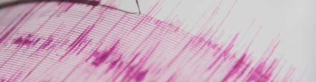
Southwestern B.C. lies near the edge of a subduction zone, where the the Juan de Fuca tectonic plate is being submerged beneath the larger North American plate. Over time, stress and compression build within the rocky crust, until the energy is suddenly released—causing the land to shudder. Geological records and Indigenous oral histories indicate that subduction earthquakes near 9.0 on the Richter scale occur in our region at intervals of between 250 and 850 years. The most recent of these cataclysms struck just over three centuries ago.

“We have this ocean plate that’s being pushed toward us at about four to five centimetres a year,” roughly the pace at which our fingernails grow, said Cassidy. “But over 100 years—over a lifetime—that represents four to five metres of movement.”

Three different types of earthquakes affect southwestern B.C., said Cassidy: the megathrust subduction earthquake discussed above; the crustal earthquake; and the deep earthquake. The latter two tend to be less intense, but are more frequent. Events like the 7.8-magnitude tremors near Haida Gwaii in late October 2012, that sparked a tsunami warning, can also pose substantial dangers.

Various levels of government have acknowledged these risks. Canada’s National Building Code requires that structures conform to a high standard of earthquake resistance, and seismologists at Natural Resources Canada have created maps of communities based on seismic dangers. The provinces each have emergency response plans, and the federal government’s Department of Aboriginal Affairs has a protocol for emergency response on First Nation reserves. The City of Vancouver, like many other municipalities, has recently updated its earthquake preparedness plan.

Emergency planning specialist Gordon Redmond believes that, while those measures are all laudable, officials and civilians alike would be better served by a more comprehensive approach to risk mitigation and response—both in terms of public safety and financial cost.

“It’s great to see that [governments] are taking these threats seriously, and that they’re looking at programs and strategies to address them,” said Redmond. However, “it would be more cost-effective if they would look at a basket of hazards” and consolidate them into a single risk assessment, he added. The price tag of natural disasters in B.C.—including fires, floods, landslides and wind storms—is rising, and according to Redmond’s calculations, cost an average of $184,000 per day from 2007-2012.

“If we did a systematic analysis of all of our hazards, we could actually determine what they are, how far they are away from us, how soon they will get here, how long they will last. And we can map out what areas of our built environment would be in harm’s way.”

As Redmond noted, a major seismic event in Vancouver could entail a cascade of problems: the collapse of buildings and other structures; the rupture of oil and gas pipelines, or water and sewage pipes; the failure of power lines, roads and bridges; the release of hazardous materials; the liquefaction of alluvial soils in the Fraser River delta; and the spread of fires through areas inaccessible to firefighters, particularly if transportation infrastructure is compromised. Finally, the potential for a tsunami is real and grave.

The aftermath of the 2011 earthquake and tsunami that struck the Tohoku region of Japan illustrates Redmond’s point. The initial earthquake damaged buildings and infrastructure, including the Fukushima Daiichi nuclear power station, and liquefied soft soils near the shore. And although sea walls encircle approximately 40 per cent of the Japanese coast line, some over 10 metres in height, the structures offered little respite from the wave, in part because the earthquake had caused the land to subside. Despite a sophisticated tsunami warning system, rigorous building codes, and world-class standards of earthquake preparedness and response, more than 19,000 perished, and over 300,000 were displaced from their homes.

“In Japan, the buildings did very well during the earthquake; it was the tsunami that caused most of the devastation, and that tsunami was larger than what they were expecting in that part of Japan,” noted Cassidy.

“When the subduction earthquake occurs off our coast, we know that parts of Vancouver Island will subside, perhaps a half metre, perhaps one or two metres,” he added—a potentiality that governments and regulators need also take into account.

Redmond recommends mapping as many threats to communities as possible, adjusting land use patterns, and taking advantage of natural geographic features to help avert potential tragedies. But another significant hurdle, he said, is dealing with various levels of government. Elected officials and staff preside over different jurisdictions, and convincing parliamentarians to plan for events more than four years down the road is sometimes a challenge.

In B.C., for example, the province has domain over Crown lands, municipalities preside over zoning, and the federal government bears responsibility for First Nations.

“Imagine: You have all these jurisdictions, with their own bureaucracies, but you only have one fire. And the fire doesn’t read your plans.”

Although tsunamis and damage to buildings and infrastructure may accompany a massive quake, the majority of injuries related to seismic events, Redmond observed, owe to a less sensational cause: falling debris in the home, workplace, and school.

For individuals and families, Redmond has simple recommendations: avoid placing heavy items on high shelves, and keep two weeks worth of food and provisions on hand, including a flashlight and replacement batteries.

“Pretend you’re going on a long camping trip,” he said.

Source: http://www.vancouverobserver.com/city/old-buildings-coastal-areas-most-vulnerable-major-earthquake-bc

Posted in: In The News

Leave a Comment (0) →

‘Frost quakes’ wake Toronto residents on cold night

As overnight temperatures in Toronto dipped to –20 C, many people again reported hearing loud booms, which CBC meteorologist Jay Scotland says was likely the result of a “frost quake.”

Many on Twitter reported hearing a loud boom overnight.

“Awaken by a loud boom — thought a family member was in trouble,” said a tweet by @JanineBaijnath.

Others reported hearing similar noises overnight as Toronto and much of the eastern half of the country were under an extreme cold weather alert.

Scotland said what they heard may have been the result of a weather phenomenon called a cryoseism, often referred to as an “ice quake.”

The boom is caused when water in the ground expands in extreme cold

“All of a sudden that ice starts to expand — it’s like having a lid on top of a bottle, that pressure builds and builds until finally something gives, the ice expands, the pressure is released, the ground cracks and we hear what sounds or even feels like a very localized earthquake,” said Scotland.

“This is not an earthquake. It’s ice expanding under the ground, and it leads to a loud boom and gets folks pretty scared when it happens in the middle of the night. Very rare, very cool but very scary.”

Ice quakes were also reported last week in Toronto.

Source: http://www.cbc.ca/news/canada/toronto/frost-quakes-wake-toronto-residents-on-cold-night-1.2482615

Posted in: In The News

Leave a Comment (0) →

Major earthquake could cause $75B in damage, study warns

Major earthquake could cause $75B in damage, study warns

Canada is unprepared for a major earthquake that would cause between $60 billion and $75 billion in damage, a new study warns.

The report, commissioned by the Insurance Bureau of Canada, says a major earthquake would have a significant economic impact on the region it hits, as well as a domino effect on the entire Canadian economy.

Nearly 4,000 earthquakes hit Canada each year, but the vast majority are too small for humans to notice.

However, there are seismically active regions both off the West Coast and in Quebec that could produce damaging earthquakes within the next 50 years. There is a 30 per cent chance of a major earthquake hitting B.C. in that time period, and a five to 15 per cent chance of a damaging quake hitting Quebec.

It’s the first study of its kind in 20 years, and highlights how unprepared Canada is for a major seismic event. The study looked at two scenarios – a major earthquake off the West Coast of British Columbia, and one in Quebec east of Quebec City.

The report does not look at loss of life or casualties, focusing solely on the impact to the economy, but says it considers an earthquake “sufficiently threatening and devastating to warrant prudent planning and preparation now.”

Earthquake scenarios

According to the report, a 9.0 magnitude earthquake off the western coast of Vancouver Island would have a major impact on the economy. It estimates that scenario would cause $62 billion in direct damage in the region, primarily due to building damage, and $12.7 billion in indirect impact caused by things like supply chain interruption and infrastructure damage.

Although most Canadians would consider a western earthquake most likely, there is a seismically active area in Quebec that could produce a lower-magnitude quake that would be less devastating but still potentially damaging.

The report’s eastern quake scenario models what would happen if a 7.1 magnitude earthquake hit to the east of Quebec City, in the Charlevoix seismic zone. That earthquake could cause $61 billion in damage, $49 billion of which would be direct impact.

Source: http://www.cbc.ca/news/business/major-earthquake-could-cause-75b-in-damage-study-warns-1.2287121

Posted in: In The News

Leave a Comment (0) →

Close to 700,000 take part in the Great B.C. Shake Out

Close to 700,000 take part in the Great B.C. Shake Out

Hundreds of thousands of people had to drop, cover and hold on this morning, taking part in the province’s largest annual earthquake drill.

The Great B.C. Shake Out happened at 10:17 this morning.

The idea is to get people to practice the skills needed if the “big one” hits.

Emergency management experts say the best course of action in the case of an earthquake is to “drop to the ground, take cover and hold on until the shaking stops.” These actions can reduce injury and death during earthquakes.

They say getting in a doorway or running outside can be dangerous during an earthquake and are part of “what not to do” list on the Great B.C. Shake Out’s website.

Organizers say the drill is also a way to remind people to put their earthquake preparedness kits together if they haven’t already.

More than 690,000 people have signed up to participate. Schools, businesses, and government organizations across the province are taking part.

Over 24.5 million people are participating worldwide.

Anyone can hold their own drill at any time within two weeks of October 17.

While B.C. is overdue for a large-magnitude earthquake, a recent survey by BCAA showed 78 per cent of British Columbians do not know how to prepare their home for an earthquake. It also found that 58 per cent are aware of a one-in-three chance of a significant earthquake striking in the next 50 years, and 75 per cent expect their home could be damaged by an earthquake.

Source: http://globalnews.ca/news/908186/close-to-700000-to-take-part-in-this-years-great-b-c-shake-out/

Posted in: In The News

Leave a Comment (0) →

Three earthquakes strike off B.C. coast; no damage, no tsunamis

Three earthquakes strike off B.C. coast; no damage, no tsunamis

A series of earthquakes struck an area off British Columbia’s coast Tuesday, but they weren’t large enough to cause damage or tsunami warnings.

The largest quake measured 6 on the Richter scale and was centred almost 200 kilometres off Bella Bella, on B.C.’s northern coast.

Natural Resources Canada says two more afternoon quakes struck within 20 minutes of each other and measured 4.5 and 4.9 on the Richter scale.

The first quake was measured at a depth of one kilometre, but the subsequent ones were at a depth of more than 10 kilometres.

The U.S. National Weather Service says the earthquakes were not expected to generate a tsunami.

Word of the earthquake was news to Bella Bella RCMP Sgt. Glen Caston, who says he didn’t feel a thing.

Caston says police haven’t heard from anyone who felt any rumbling.

“It must have been a pretty soft earthquake,” Caston said.

Earthquake Canada measured the first quake slightly higher at 6.1, and says there are no reports of damage and none would be expected.

Source: http://www.theglobeandmail.com/news/british-columbia/shallow-earthquake-rattles-bc-coast/article14092328/

Posted in: In The News

Leave a Comment (0) →

4 things to know about earthquakes

4 things to know about earthquakes

An earthquake can be one of the most destructive events in the natural world. More than three million people were killed in quakes in the 20th century alone. Although scientists are able to predict which regions are most likely to be hit, it is impossible to predict precisely when a major temblor will occur.

Major earthquakes are unpredictable and can kill thousands of people and obliterate homes, buildings and roads in a matter of seconds. Undersea quakes can also trigger destructive tsunamis.

The damage from earthquakes can reach a massive scale. On Mar. 11, 2011, for example, Japan was rocked by a massive 9.0-magnitude earthquake that struck off the coast of the country’s northeast, causing a huge tsunami that swallowed homes, swept away cars and boats, and forced people to scramble for higher ground. More than 15,850 people were confirmed dead; 3,203 were unaccounted for; and 452,000 were displaced from their homes and are living in shelters. A year later, more than 80,000 were still unable to return home due to radiation from the Fukushima Daiichi reactor damaged by the quake and tsunami.

What is an earthquake?

The ground beneath our feet seems rock-solid, but our planet’s surface is in fact a dynamic grid of slowly moving sections, known as tectonic plates. Normally, this motion is imperceptible to humans, showing itself only on geological time scales (North America and Europe, for example, are drifting apart at the rate of just five centimetres per year).

The movement causes stress to build in the crust. If the stress rises beyond a critical threshold, a portion of the crust will give way, shifting suddenly and violently. This sudden motion usually occurs along a fault or fracture – a zone of weakness in the earth’s crust. The result is what we call an earthquake.

“You can only push a rock so far,” explains Joseph Wallach, a geologist at the University of Ottawa. “At a certain point in time, the rock will fail, and you’ll have an earthquake.” Ninety per cent of earthquakes occur along the boundaries of tectonic plates, but they can also happen in more stable regions, thousands of kilometres from the plate edges.

The destructive power of an earthquake depends on the depth of its point of focus. The spot on the earth’s surface directly above the focus is called the “epicentre.”

For the most common quakes, known as “shallow-focus” events, the focus is just a few dozen kilometres below the surface. Because the crust is in motion so close to the surface, these are the most powerful and deadliest quakes.

In contrast, “deep focus” earthquakes originate hundreds of kilometres below the surface, and cause less damage.

Earthquakes can also occur beneath the ocean; such oceanic quakes can trigger enormous tidal waves, or tsunamis. These waves can travel great distances at speeds of up to 1,000 kilometres per hour, attaining heights of up to 15 metres as they reach the shore.

How are earthquakes measured?

The first practical scale for measuring earthquakes was developed by geologist Charles Richter at the California Institute of Technology in the 1930s.

Experts now talk about “moment magnitude.” The number referenced as an earthquake’s magnitude is an estimate of how much and how far the earth moved at a specific time.

The energy released by an earthquake goes up by a factor of 32 for each one-point increase in magnitude. A quake with magnitude between 2 and 3 is the lowest normally perceptible to humans. A magnitude 5 quake is considered moderate. Worldwide, there are about 1,500 earthquakes of magnitude 5 or higher every year. An earthquake of magnitude 6 or higher is considered major. The largest earthquakes in history have been of about magnitude 9.

Major earthquakes release far more energy than any man-made explosion. The 1906 San Francisco earthquake, with a magnitude of 8.3, was approximately one million times as powerful as the atomic bomb dropped on Hiroshima.

Where do earthquakes occur?

Earthquakes usually occur at the junction of two tectonic plates. These boundary regions, therefore, are particularly prone to earthquakes (and also to volcanic eruptions).

The edges of the giant Pacific plate, which lies beneath the Pacific Ocean, form a particularly intense ring of tectonic activity, known as the “ring of fire.” This activity causes frequent earthquakes along the west coast of North America and in Chile, Alaska and Japan, and is also responsible for volcanic eruptions in the northwest United States, the Andes Mountains, and the Philippines.

Not all earthquakes occur at plate boundaries. In the early 19th century, a series of powerful earthquakes struck the Mississippi Valley in the United States. Named for the Missouri town nearest the epicentre, the New Madrid quakes of 1811 and 1812 were probably the most powerful in recorded North American history, with magnitudes of 8.4 to 8.7. There was little damage and few casualties, as the area was still sparsely populated at that time, but the tremors were felt as far away as Boston and Denver. The area, far from the edges of any tectonic plates, is what geologists call a “stable continental region” (SCR). While seismologists and historians have learned a great deal about these 190-year-old quakes, their cause is still a mystery; there have been very few major SCR earthquakes since.

The area of eastern Turkey which was struck by an earthquake on Oct. 23, 2011, is one of the most seismically active areas of the world, says CBC meteorologist Johanna Wagstaffe, who is also a seismologist. That quake was what’s referred to as a transform fault, where two plates slide beside each other.

“Turkey is actually on its own plate, called the Anatolian plate, and so it’s bumping and grinding with plates to the north, the Eurasian plate, [and] it’s sliding and bumping with the Arabian plate to the south,” she said.

Can earthquakes be predicted?

No one can tell exactly where or when the next major earthquake will occur. Seismologists have, however, several methods at their disposal that can at least allow them to make educated guesses.

First, a statistical study of historical earthquakes in a given region shows how frequent quakes of various magnitudes have been in the past. From those figures, they can guess how likely future quakes will be. For example, if a certain region has been struck by four magnitude 7 quakes in the last 200 years, seismologists would say there is a 50 per cent probability of another such quake occurring in the next 50 years.

Seismologists can also measure how much stress a certain region of the earth’s crust is under, and how quickly that stress is increasing. That knowledge, along with the elapsed time since the last earthquake, helps scientists determine if another earthquake is on the way. This method is far from perfect, though, and requires extremely detailed seismological data, which simply isn’t available for most regions.

Source: http://www.cbc.ca/news/technology/story/2009/06/23/f-earthquakes-forces-nature.html

Posted in: In The News

Leave a Comment (0) →

6.1 magnitude earthquake strikes off B.C. coast

6.1 magnitude earthquake strikes off B.C. coast

A 6.1 magnitude earthquake struck off the northwest coast of Vancouver Island at 1:19 p.m. PT Tuesday, followed by a series of at least five aftershocks, but officials say no tsunami is expected.

The U.S. National Oceanic and Atmospheric Administration’s National Weather Service was the first to report the quake’s epicentre was approximately 150 kilometres northwest of Port Alice, on Vancouver Island, but said a tsunami was not expected.

The quake was initially rated 6.2 magnitude by the NOAA, but then downgraded to 6.0 by the USGS, while Natural Resources Canada rated the quake 6.1 magnitude.

NRC seismologist Alison Bird says there is no cause for concern because the quake was out in the ocean rather than underneath people.

“I would consider this to be a moderate earthquake. It doesn’t pose any threat to people. There is no tsunami expected. We haven’t even received any fault reports yet. It’s far enough away from communities that it really isn’t any worry,” said Bird.

Residents in Bella Bella, Port Alice and Port Hardy contacted by CBC News said they did not feel the quake or its aftershocks, but Bird says it is a reminder folks should take part in the province-wide Shakeout B.C. earthquake drill next month.

At least five aftershocks were reported in the same area including a 4.6 magnitude at 2:05 p.m, a 4.8 magnitude at 2:25 p.m., a 5.0 magnitude at 3:29., 4.2 magnitude at 4:07, and 5.9 magnitude at 5:23 p.m.

“The earthquakes had ‘strike-slip’ mechanisms which means the motion was mainly horizontal,” said CBC meteorologist Johanna Wagstaffe, who has a background in seismology.

“Here, two plates are sliding past each other, rather than one plate moving underneath another one. These quakes are likely connected to the Queen Charlotte fault rather than the Cascadia subduction zone, but this is a complicated section of West Coast tectonics. It’s possible these quakes are connected to last year’s October 2012 7.8 magnitude quake as well.”

The area of the ocean floor west and north of B.C., often referred to as the Pacific Ring of Fire, is known for its seismic activity.

On Tuesday evening, a magnitude 6.5 earthquake struck near the Izu Islands in southern Japan. Tremors were felt in Tokyo, but no damage was reported and no tsunami expected. The Japan quake was not connected to the B.C. quakes.

On Monday, a much smaller 3.9 magnitude earthquake registered approximately 119 kilometres southwest of Port Alice, according to Natural Resources Canada.

Farther to the northwest, a 7.0 quake last week shook near the coast of Adak, one of Alaska’s Aleutian Islands.

Source: http://www.cbc.ca/news/canada/british-columbia/story/2013/09/03/bc-earthquake-pacific-tsunami.html

Posted in: In The News

Leave a Comment (0) →

The Cascadia Fault: An Inconvenient Truth

The Cascadia Fault: An Inconvenient Truth

The human and economic devastation of the coming West Coast earthquakes is unimaginable. Whether it’s the magnitude-9 Big One that strikes first, or smaller—but equally deadly—temblors, recovery will take years, not weeks. Almost half of small businesses will fail. Hundreds of thousands of British Columbians will leave and never return. But as with any inevitability, there’s money to be made before and after the Cascadia fault changes our lives forever.

Now. Or now. Next Thursday. Tomorrow while you sleep. One morning as you’re crossing the Alex Fraser Bridge or inching through the George Massey Tunnel, thinking about time and traffic and lunch options when suddenly the pavement shrugs and the earth begins its awful dance while stolid structures begin undulating like studies in a surrealist’s sketchbook. It’s the Big One. First you pray that you—and your family and friends—will be the lucky ones. Next you ask yourself if you’re prepared. But none of us are in this alone, and the general state of affairs after a major earthquake will depend on more than just your household emergency kit. It will also depend in part on the preparations of business and government.

When? We’re better at predicting terrorist attacks than earthquakes, but don’t try telling that to the Italians. After an April 6, 2009, earthquake that killed 300 people in the Italian city of L’Aquila, seven scientists and engineers were convicted of manslaughter for their failure to properly warn residents. Like tribal shamen who fail to warn of catastrophe, they were sacrificed to that greatest of scientific uncertainties—the exact timing of our planet’s deadly tectonic adjustments.

The Cascadia fault—also known in more paranoid circles as the Cascadia Subduction Zone—runs offshore from somewhere near the top of Vancouver Island to northern California. Over the past five millennia it has ruptured with terrifying frequency. It will certainly rupture again, but this time with a string of 21st-century cities—high-rising, dense-with-people, globally interdependent regional capitals—stacked squarely in its impact zone.

One of the most recent probability surveys was done by the Oregon Seismic Safety Policy Advisory Commission. Based on comparisons with the 2011 Japanese quake and tsunami, the Oregon study predicts a massive Cascadia quake could kill 10,000 people and cause $32 billion in damage in an area ranging from Vancouver Island to Vancouver and down as far as northern California.
Most British Columbians are not ready. But at least they know it. An Angus Reid poll conducted last year showed 61 per cent of B.C. adults are concerned about being personally affected by an earthquake and fully 87 per cent believe a major quake is coming within 50 years. And yet 60 per cent admit that they do not have an emergency kit—70 per cent have no emergency plan.
Although seemingly negligent to Californians and the Japanese, B.C.’s indifference shouldn’t be that surprising, considering the example being set at the top. A 2006 study by Zeidler Partnership Architects commissioned by the provincial government (but never released until it was revealed in 2011 by reporter Stanley Tromp in the Tyee) stated that unless Victoria’s provincial legislature receives well over $200 million in seismic upgrades, it will very likely suffer major damage in a significant temblor, resulting in considerable loss of life. Whatever other damage it might cause, a major quake would probably cripple the provincial government for months.

Who is most at risk? We’re all supposed to be asking that question but the really motivated people are insurance companies. Around the world actuaries map out areas of relative risk, known in the industry as CRESTA zones (Catastrophe Risk Evaluating and Standardizing Target Accumulations, an unwieldy name reportedly created to match the Cresta Hotel in Davos, Switzerland, where the system was devised in the late ’70s). In Canada an industry group, the Institute for Catastrophic Loss Reduction (ICLR, not as yet a hotel name), created a Canadian actuarial map that ranks seismic risk for individual postal codes. Thirteen B.C. codes fall into the “Extreme” category—all located in Victoria, Delta and Richmond. V7B, the postal code for YVR Airport, is among those extreme risk areas. Think about that: an airport that handled 17.6 million people in 2012, the air-traffic entry point into Vancouver, might be rendered unusable for months at any moment. According to YVR’s own figures the airport contributes $1.9 billion to Canadian GDP annually (as well as employing 23,600 people). YVR spokesperson Alisa Gloag says that the facility is very focused on seismic concerns—“Parts of the original 1968 domestic terminal are currently undergoing seismic upgrades,” she points out—but she’s cautious about the potential for runway damage. “It all depends on magnitude and location,” Gloag says. “We have three runways, so if one was damaged, then we would be able to adjust our operations accordingly.”

It all depends, indeed.

Four more codes fall into the “Very High” category—V8N and V9B in Greater Victoria, V4L in Delta and V4R in Maple Ridge. Two Abbotsford codes (V2S and V2T) are ranked “High,” as are V7P (southwest North Vancouver), V8W (home to the provincial legislature) and V9A (containing the Canadian Forces base in Esquimalt), among others. The bulk of Vancouver and neighbouring regions—Burnaby, Surrey, Coquitlam, Port Coquitlam, etc.—rank as “Moderate” or “Low.” (This means moderate or low risk for this region—it does not mean that the quake damage risk in Vancouver is as low as that of, say, Regina.)…

Source: http://www.bcbusiness.ca/tech-science/the-cascadia-fault-an-inconvenient-truth

Posted in: In The News

Leave a Comment (0) →

Earthquake rattles northern Vancouver Island, no injuries

Earthquake rattles northern Vancouver Island, no injuries

A “moderate” quake shook the northern end of Vancouver Island early Sunday morning, waking many people in their beds as windows rattled and blinds swayed from the tremors.

Earthquakes Canada said the 5.5 magnitude quake hit at about 6:20 a.m. local time about 25 kilometres west of Nootka Island, off the north coast of Vancouver Island.

There were no reports of any damage or injuries, and no tsunami was expected.

“It woke up many people in communities on northern Vancouver Island,” said John Cassidy, an earthquake seismologist with Natural Resources Canada.

“Because the earthquake was far enough away it wasn’t strong enough to knock items off shelves or cause any damage but people certainly noticed five to 10 seconds of shaking where things were swaying back and forth.”

Vancouver Island communities that felt the quake included Port Alice, Port McNeill, Port Hardy, Tahsis, Sointula and Alert Bay.

Residents living in small communities on Nootka Island felt the quake as well.

The quake was caused by ocean plates rubbing together in a region known as the Nootka fault zone, said Cassidy.

“This is one of the seismic hotspots along the west coast,” he said.

“We tend to get a band of seismicity along the region where those two ocean plates meet, and that’s where today’s earthquake occurred, it’s a boundary between those two ocean plates.”

Although the early-morning quake didn’t cause any damage or injuries, it was a reminder of seismic activity in the area, said Cassidy.

“We live in a very active region. This is a direct result of plate movement,” he said. “We know that energy is being stored for

much larger earthquakes in the future…being prepared, knowing what to do, is really important.”

Earthquakes Canada said small aftershocks from the quake could be felt through Sunday.

During an earthquake, those inside a home or building are advised to drop down and crawl under strong furniture, cover their head and neck and stay away from windows and shelves with heavy objects.

If unable to go under something strong, crouching or flattening oneself against an interior wall is advised.

Those outdoors during an earthquake are advised to stay away from power lines, buildings and the shore. Those in vehicles are advised to pull over and stay inside.

Source: http://www.cbc.ca/news/canada/british-columbia/story/2013/08/04/vancouver-island-earthquake.html

Posted in: In The News

Leave a Comment (0) →
Page 16 of 18 «...101415161718