Author Archive

Why have there been so many earthquakes off the coast of B.C.?

Why have there been so many earthquakes off the coast of B.C.?

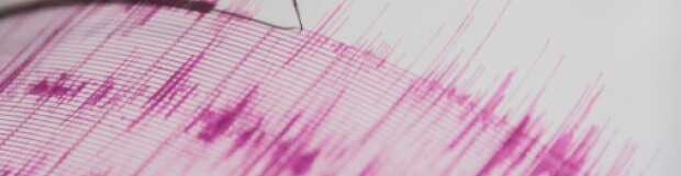
Over the past month there have been 169 earthquakes of magnitude 2.5 or above off the coast of British Columbia. Is this a sign of the “big one?”

“There has been a slight increase in activity,” said Alison Bird, seismologist with Natural Resources Canada. “But from time to time we have swarm activity off the coast.”

In fact, the last time it was so active was September 2013.

“It’s pretty routine. With the kinds of tectonics in this region, the forces that the plates are under, it’s not a surprise that we have a sudden burst of small earthquakes.”

There are many faults in that area west of Port Hardy. You have plates moving away from each other, others that are moving side by side, and then one plate that is sliding under another. All those different motions make it a hotbed of activity.

Bird said that it’s unlikely that this swarm is associated with anything larger. That’s because it’s not in the right area, and that swarms don’t necessarily indicate something larger.

Still, though it happens from time to time, that doesn’t mean that B.C. residents shouldn’t always be prepared.

Paul Caruso, a geophysicist with the U.S. Geological Survey, concurred.

“No one knows for sure,” he said. “We do get these swarms from time to time but that’s because it’s a very active area.”

For the mega-thrust earthquake — the one we tend to call “The Big One” which would be somewhere near magnitude 9 — Bird says there is a one-in-ten chance of that happening within the next 50 years.

But if people are prepared for that one, they will be prepared for anything.

When it comes to the Victoria area, there is a one in three chance of of magnitude 6 or bigger in the next 50 years.

The magnitude 4.6 earthquake in Tofino is separate from the swarm occurring off the coast, but earthquakes occur in that region almost every day, Bird said. It’s just that that one was a little larger than most.

B.C. residents aren’t strangers to the shaking and rattling of the earth. But it’s possible that, because a large earthquake hasn’t occurred in a long time, people forget that one day they could face a much more dangerous situation.

“They’re a good reminder that this is earthquake country. We really have to respect that,” Bird said. “The thing is, we haven’t had anything truly large for so long that people have become complacent and don’t grasp the threat in the region.”

Bird has some advice.

“Just be prepared regardless of what’s happening with the earthquakes.”

Source: http://globalnews.ca/news/1762471/why-have-there-been-so-many-earthquakes-off-the-coast-of-b-c/

Posted in: In The News

Leave a Comment (0) →

Fracking triggered hundreds of earthquakes in northern B.C., says Oil and Gas Commission

Fracking triggered hundreds of earthquakes in northern B.C., says Oil and Gas Commission

Fracking caused hundreds of seismic events in the Montney basin area surrounding Fort St. John and Dawson Creek between August 2013 and October 2014, including 11 earthquakes that could be felt on the surface, a new British Columbia Oil and Gas Commission report states.

However, no person or property was injured as a result of those earthquakes, according to the report.

The number of earthquakes is associated with development, according to an oil and gas industry executive.

“I would think that the percentage of induced events will be definitely scaled back or forward with activity counts,” said Brad Herald, vice-president of Western Canada Operations for the Canadian Association of Petroleum Producers (CAPP).

The amount of seismic events caused by oil and gas operations that could not be felt on the surface was much higher. There were about 220 seismic events in the Montney in those circumstances.

The earthquakes ranged from 1 to 4.4 on the Mercalli scale. The Mercalli scale, which is used in place of the Richter scale, measures earthquake magnitude.

According to the U.S. Geological Service, 1 to 3 magnitude quakes can rarely be felt on the surface. The majority of the earthquakes were in this category. A 3 to 3.9 magnitude quake can be “felt only by a few persons at best, especially on upper floors of buildings.” Less than 10 of these events were in this category. A 4 to 4.9 earthquake can be felt indoors by many, and outdoors by few. It could also wake some people up. Only one or two events were in this category.

The majority of the seismic events — about 84% — came as a result of regular fracking well operations. The other 16% were caused by disposal wells.

But the report stated that two disposal wells created 38 seismic events.

B.C. has 104 disposal wells within its borders.

Hydraulic fracturing — the process used to extract natural gas from deep underground — has long been linked to earthquakes.

“I don’t think it’s a surprise to us,” said Herald. “We monitor those active areas globally in terms of induced seismicity to hydraulic fracturing … we do understand that in some instances there’s induced seismicity related to hydraulic fracturing.”

Last year, his group came forward with a list of operating guidelines to help operators deal with the possibility of earthquakes.

“Industry takes this very seriously and we understand the public has concerns about the issue,” Herald added. “There has been no injuries and no damage to property, but it’s still a felt event, they can be unsettling for people at the surface.”

He further explained that the likelihood of fracking-caused earthquakes would depend on where activities were taking place. In 2012, fracking was linked to earthquakes in the Horn River basin — the area around Northern Rockies Regional Municipality.

But the Montney basin area has seen more development. By August 2014, close to 90% of fracking operations occurred in the Montney area, the OGC report stated.

“We want to understand where the events are occurring,” said Herald.

Questions sent to the OGC about whether or not they expected these events to increase either in strength or numbers were not returned as of press time.

Report recommendations supported by CAPP

The report also made some recommendations about seismic events caused by fracking.

Three included identifying pre-existing faults, a dense array deploment requested in certain areas where more information is needed, fault zone avoidance for fracking operations, and early flow back of fluids used in fracking.

Herald said that his group was supportive of the recommendations.

Source: http://www.biv.com/article/2015/1/fracking-triggered-hundreds-earthquakes-northern-b/

Posted in: In The News

Leave a Comment (0) →

Magnitude 4.8 earthquake near Tofino, B.C., rattles houses

Magnitude 4.8 earthquake near Tofino, B.C., rattles houses

Vancouver Island residents reported houses rattling after an earthquake struck shortly after 6 p.m. PT Wednesday.

The 4.8 magnitude quake hit 18 kilometres east-northeast of Tofino, B.C., at a depth of 24 kilometres.

A tsunami is not expected and there were no reports of damage.

Residents in Courtenay, Campbell River and Qualicum Beach reported beds shaking and dishes rattling in their cupboards.

“Staying in a log cabin in Tofino and we thought a truck had hit something,” tweeted one resident.

Hayes Bishop, who works at Middle Beach Lodge in Tofino, said the shaking lasted for about 20 seconds.

“I felt some vibrations and I looked up and I was able to see the window shaking,” he said. “Yeah, you could definitely feel it.”

“Quite a few of the guests came downstairs to ask if that was indeed an earthquake, and there is definitely some cause for concern because we are very close to the ocean here.”

The quake was also felt in the Gulf Islands and as far away as the Lower Mainland, according to some reports.

Earthquake latest in a series

Wednesday’s shaker is the latest in a series of recent quakes that have struck off the B.C. coast.

Last Friday and Saturday separate earthquakes with respective magnitudes of 5.2 and 4.5 struck 200 km off the coast of Port Hardy at the northern end of Vancouver Island.

A swarm of five earthquakes also struck west of Port Hardy further in late December, at depths ranging from 10 to 22 km.

According to the Geological Survey of Canada, these clusters are larger than normal, but not unusual, nor does it effectively increase the risk of the “big one.”

CBC meteorologist Johanna Wagstaffe said Wednesday night’s quake likely occurred within the overriding North America plate.

The smaller quakes can sometimes be damaging because of the shallow depth, she said, even though the recent ones in the past month haven’t fit that characterization.

Wagstaffe said the “big one,” a damaging megathrust earthquake, will occur within the Juan de Fuca plate which has become stuck trying to move under the North American plate. She said these are at two very different locations.

Source: http://www.cbc.ca/news/canada/british-columbia/magnitude-4-8-earthquake-near-tofino-b-c-rattles-houses-1.2893418

Posted in: In The News

Leave a Comment (0) →

4.5 magnitude earthquake reported off B.C. coast

4.5 magnitude earthquake reported off B.C. coast

VANCOUVER – A 4.5 magnitude earthquake has struck 208 kilometres west of the northern tip of Vancouver Island.

The federal agency that monitors earthquakes in Canada says no damage or tsunami was expected nor were tremors felt as a result of the event west of Port Hardy, B.C.

A 5.4 magnitude earthquake struck 211 kilometres west of the Vancouver Island community on Friday and was slightly felt in the city of Campbell River and the Metro Vancouver city of New Westminster.

A 4.3 magnitude earthquake struck 517 kilometres northwest of Vancouver Island last weekend.

Earthquakes Canada reported five earthquakes off B.C.’s coast the weekend of Dec. 20 and Dec. 21.

Earthquakes are common off the B.C. coast, where the Juan de Fuca tectonic plate meets the Pacific tectonic plate, but few are large enough to be felt by people.

Source: http://globalnews.ca/news/1754035/4-5-magnitude-earthquake-reported-off-b-c-coast/

Posted in: In The News

Leave a Comment (0) →

5.4 magnitude earthquake hits off coast of Vancouver Island

5.4 magnitude earthquake hits off coast of Vancouver Island

VANCOUVER – A 5.4 magnitude earthquake struck off the coast of Vancouver Island on Friday morning, two weeks after an earthquake hit in almost the same location.

Earthquakes Canada says Friday’s quake hit at 2:15 a.m. off the west coast of the island, on the boundary of the Juan de Fuca plate system and the North America Plate, on the spreading centre. There are no reports of any damage or injuries, but residents of Campbell River, Vancouver and New Westminster may have felt some light shaking.

On Saturday, Dec. 20, a 4.3 magnitude earthquake struck the same region. There was no damage or tsunami from that quake.

Earthquakes Canada has recorded five earthquakes off B.C.’s coast during the weekend of Dec. 20 and Dec. 21, 2014.

“We’ve had a number of earthquakes up there,” said Taimi Mulder, from the Natural Resources Canada, Geological Survey of Canada. “In that area there often, once or twice a year there could be a magnitude 5 there.”

She said this is not unusual activity for that area and there has been a lot of small plate shifting since the Haida Gwaii earthquake in October, 2012. “In the last two, three years it has been a little more active,” said Mulder.

“Five is on the order where you would start to see damage if it was to happen on land.”

Source: http://globalnews.ca/news/1752762/5-4-magnitude-earthquake-hits-off-coast-of-vancouver-island/

Posted in: In The News

Leave a Comment (0) →

Five powerful earthquakes rattle B.C., edges of the Pacific plate over the weekend

Five powerful earthquakes rattle B.C., edges of the Pacific plate over the weekend

A series of five strong earthquakes rattled coastal B.C. this weekend, starting just a few hours before five more — including a magnitude 6.6 quake — hit Indonesia.

The B.C. quakes measured from 4.0 to 5.1 in magnitude and were centred offshore between Haida Gwaii and Vancouver Island, about 200 kilometres southwest of Bella Bella, according to the U.S. Geological Survey.

In all, 15 earthquakes measuring above 4.0 were detected from about 3 p.m. Saturday to 5 p.m. Sunday at spots around the perimeter of the Pacific Plate, which runs along the western edge of North America from the Baja California peninsula to the Aleutian Islands in the north, and south from Russia to New Zealand, via coastal Japan, Indonesia, and the Philippines.

Though some earthquakes are known to trigger others, it is unlikely that happened this weekend, say experts in the field.

“The earth is hugely seismically active,” said Brett Gilley, an instructor with the University of B.C.’s Earth, Ocean and Atmospheric Sciences Department.

He said it is not uncommon for earthquakes to cluster locally as happened in B.C., then Indonesia.

“Earthquakes often happen in swarms,” said Gilley, noting that those off the B.C. coast were of similar size. “What’s happening is the stress is sort of adjusting over the whole area.”

With so-called transform earthquakes, like those that happen along the San Andreas Fault in California, experts can sometimes make a loose prediction that one quake might trigger another nearby, said Gilley. But with subduction zones, like that where the Juan de Fuca plate meets the North American plate, the relationship between one quake and another is harder to predict.

Dan Gibson, an assistant professor in Earth Sciences at Simon Fraser University, said it would take a very large earthquake, in the magnitude of 8 or more, to set off others, though the relationship is still hard to prove or disprove.

He pointed to a unique 8.6 magnitude transform earthquake that happened off the west coast of Sumatra in 2012 that is thought to have triggered other major quakes around the world.

“That was such a big one, and it may have been unique circumstances where there was a slight (lull) in earthquake activity and a bunch of built-up stress along plate boundaries, that it began to trigger other ones,” said Gibson.

“They were ready. They were sort of at a critical state already and then there was just enough energy transmitted … that it caused the other ones to release.”

Earthquake waves can travel the roughly 11,000 kilometres from B.C. to Indonesia in about two hours, said Gibson, but those from a quake of Sunday’s magnitude would be so degraded by the time they arrived they would need to be measured by seismometers.

Brent Ward, an Associate Professor of Earth Sciences at SFU, said a 5.1 quake off the West Coast as happened around 7 p.m. Saturday “is fairly big,” but he didn’t think the shaking at either side of the Pacific was related.

“There’s tens of hundreds of earthquakes every day,” he said, adding that scientists generally “don’t think there’s an association between quakes in far flung areas.”

Source: http://www.vancouversun.com/technology/Five+powerful+earthquakes+rattle+edges+Pacific+plate+over+weekend/10671848/story.html

Posted in: In The News

Leave a Comment (0) →

Earthquake detected off British Columbia

Earthquake detected off British Columbia

VANCOUVER – There was a 4.3 magnitude earthquake off the coast of B.C. on Saturday afternoon.

The federal agency that monitors earthquakes in Canada says the tremor was centred offshore about 517 kilometres west northwest of Vancouver.

Earthquakes Canada says there are no reports of damage, but none would be expected given the location of the quake.

The earthquake centre says no tsunami would be expected.

Source: http://globalnews.ca/news/1738289/earthquake-detected-off-british-columbia/

Posted in: In The News

Leave a Comment (0) →

Cascadia’s Locked Fault Means Massive Earthquake Is Due in Pacific Northwest: Seismologists

The Cascadia fault in the Pacific Northwest is locked up, meaning that a massive megathrust earthquake could occur at any time, seismologists are warning.

“It’s impossible to know exactly when the next Cascadia earthquake will occur,” said Evelyn Roeloffs of the U.S. Geological Survey, speaking last year on the 313th anniversary of a massive quake that hit in 1700—the last major one in the region. “We can’t be sure that it won’t be tomorrow, and we shouldn’t make the mistake of assuming we have decades to prepare.”

The tectonic plates normally glide and rub against each other, but periodically they become wedged together. When the fault quits sliding and becomes “locked” in place, it builds energy until it finally ruptures, relieving hundreds or thousands of years of stored-up stress in seconds, Roeloff said.

Now, earthquake scientists from Canada and the U.S. who monitor seismic activity along the Cascadia coast have concluded that the dangerous fault line is fully locked, which carries serious implications for an earthquake in the Pacific Northwest.

“What is extraordinary is that all of Cascadia is quiet,” University of Oregon geophysics professor Doug Toomey told the Associated Press earlier this month.

Research on the Cascadia Subduction Zone in 2012 and 2013 led researchers to similar conclusions.

A big unknown, Toomey told AP, is how much strain has accumulated since the plate boundary seized up, and how much more strain can build up before the fault rips and unleashes a possible magnitude 9.0 megaquake and tsunami.

“If there were low levels of offshore seismicity, then we could say some strain is being released by the smaller events,” Toomey told AP. “If it is completely locked, it means it is increasingly storing energy, and that has to be released at some point.”

Toomey said he is “very concerned” and said it is imperative that people in the Northwest continue to prepare for a big earthquake.

Cascadia’s Subduction Zone is a very long, very dangerous undersea fault that divides the Juan de Fuca oceanic and the North America continental plates. It runs from British Columbia down through Washington and Oregon and into northern California, as does a volcanic mountain range.

The fault has produced at least seven magnitude 9.0 or greater megathrust earthquakes in the past 3,500 years, a frequency that indicates a return time of 300 to 600 years.

The massive earthquake on the night of January 26, 1700, was one of the world’s largest. The Cascadia fault ruptured along a 680-mile stretch, from the middle of Vancouver Island to northern California, producing tremendous shaking and a huge tsunami that swept across the Pacific.

The oral history of the Makah Tribe in Washington tells of a huge earthquake that happened in the middle of the night long ago. Those who had heeded their elder’s advice to run for high ground survived. After spending a cold night in the hills with animals that also had fled the rushing waters, the survivors found that their village, along with neighboring coastal villages, had completely washed away, leaving no survivors.

Today it’s quite common to see cars backed into parking spaces in the tribal coastal villages in Washington so that in the event of a tsunami warning, drivers can make a fast getaway to higher ground. And at least one tribe, the Quileute Nation, is moving its coastal village away from the tsunami danger zone.

An emergency kit and plan are important first steps in being prepared. Download the Red Cross Earthquake Safety Checklist to learn more. Those with smart phones can text “GETQUAKE” to 90999 or search “Red Cross Earthquake” for their mobile app in the Apple App Store for iPhones or Google Play for Android.

Source: http://indiancountrytodaymedianetwork.com/2014/12/16/cascadias-locked-fault-means-massive-earthquake-due-pacific-northwest-seismologists

Posted in: In The News

Leave a Comment (0) →

Small earthquake strikes B.C. coast off Sechelt

Small earthquake strikes B.C. coast off Sechelt

A 3.2-magnitude earthquake that struck off the B.C. coast early Thursday morning may have been felt by some residents on Vancouver Island and in the Gulf Islands.

The small quake was recorded underwater between 17 kilometres west of Sechelt shortly before 7 a.m., according to Natural Resources Canada.

The agency said the quake was “lightly felt” in Powell River, Roberts Creek and Salt Spring Island.

There are no reports of damage, and none are expected.

Source: http://www.vancouversun.com/news/Small+earthquake+strikes+coast+Sechelt/10460283/story.html

Posted in: In The News

Leave a Comment (0) →

Seismic risk rises at some B.C. dams

Seismic risk rises at some B.C. dams

Six-year BC Hydro study gives better understanding of earthquake impact.

BC Hydro will draw down the water level at an Interior dam and offer to buy 11 homes in the path of a Vancouver Island dam in response to a $10-million study that has better identified major earthquake hazards.

The study, which took six years and involved 25 international experts, used the latest scientific information on earthquakes and applied methods created by the U.S. nuclear industry to determine seismic risks.

The 3,500-page, four-volume report, Probabilistic Seismic Hazard Analysis, determined the hazard from a major earthquake was the same or lower than previously understood at power dams on the Peace River system in northern B.C. and the Columbia River system in the Southern Interior.

But it also found an increase in seismic hazard risks on the Campbell River system and the Jordan River system near Sooke, both on Vancouver Island. The seismic hazard has also increased on the Bridge River system near Lillooet in the Interior.

BC Hydro officials stressed the province’s hydro dams are safe given the new information, but it is important to prepare for the possibility of a major earthquake, the kind that could happen once in 1,000 years.

Officials also said the study will help them better prioritize spending of $1.9 billion earmarked for seismic and safety upgrades in the next decade, $700 million of that targeted for Vancouver Island.

The new information does not affect Hydro’s existing plan for electricity rates to homeowners, businesses and industrial users.

BC Hydro also plans to make a major effort to reach out to the public and First Nations about how to prepare for the consequence of a dam break in the event of a major earthquake, which includes having a plan to get out of the path of the ensuing flood or to high ground. “It’s pretty much a landmark study … It’s excellent, worldleading work. It’s been all scientifically peer-reviewed, poked at and prodded, so we are sure we have the best possible science to support decision making going forward,” said Chris O’Riley, BC Hydro’s executive vice-president of generation.

“We see this as an opportunity to have a larger conversation with the public around emergency preparedness, particularly on Vancouver Island. The seismic risk is real. It’s something we live with every day,” he noted.

The study found the Jordan River system on Vancouver Island near Sooke has the highest seismic hazard in B.C., possibly in Canada.

BC Hydro has concluded it is not feasible to reduce the reservoir level because the water is needed to produce power at peak times for the Victoria area. Nor was it deemed practical to rebuild the dam system, which would cost hundreds of millions of dollars.

That’s why Hydro decided it would offer to buy the 11 homes in the flood path of the dam, to reduce the consequence of a failure, said O’Riley.

The Crown corporation’s plan also includes lowering the maximum reservoir level by 16 metres at the LaJoie dam on the Bridge River system near Lillooet in the Interior. That will take the load off the dam and diminish seismic risks to an acceptable level, said O’Riley.

The lower reservoir level will affect Hydro’s generation capacity, but not significantly.

BC Hydro already has an upgrade plan underway on the Campbell River system, where an increase in seismic hazard was found.

The first stage, which broke ground this fall, is the $1-billion replacement of the John Hart generating station. That project will take three to four years, but will allow the reservoir level to be lowered and more detailed seismic upgrades to take place on the system in the next 10 to 20 years.

The new study allowed BC Hydro officials to decrease the uncertainty of their modelling results and better understand the level of ground motion that would take place at dam sites throughout the province when a major earthquake takes place.

A key finding of the study was that a major earthquake triggered at the Cascadia subduction zone off B.C’s coast – where the ocean plate is pushing underneath North America’s continental plate – will cause longer ground shaking than understood previously.

A 2013 study by Royal Roads University, the Geological Survey of Canada, the University of B.C. and the University of California concluded the Pacific coast has experienced 22 major earthquakes over the past 11,000 years and is due for another.

Researchers said there is evidence the last major earthquake from this zone took place around 1700.

Source: http://www.vancouversun.com/news/Seismic+risk+rises+some+dams/10442377/story.html

Posted in: In The News

Leave a Comment (0) →
Page 11 of 18 «...910111213...»