On alert for the Big One
Placing earthquake sensors in 50 schools is step one of a UBC engineer’s vision for a life-saving warning network
Ten, 20 or 30 seconds might not sound like a lot of time, but it could make a big difference when an earthquake hits.
A new earthquake early-warning system created by University of British Columbia engineers senses earthquakes before the ground starts shaking and triggers a warning alarm that could give people time to find shelter.
“When the shaking starts you tend to go into denial,” says Carlos Ventura, director of UBC’s Earthquake Engineering Research Facility. “You think it’s a truck going by, construction, or kids running around and you lose precious seconds that can make a difference between being safe and being injured.”
The civil engineering professor and his team are installing the earthquake early-warning systems in B.C. schools and training students, teachers and staff to react quickly when the alarm sounds.
How it works
The alert system consists of motion sensors or accelerometers buried two metres underground. They detect primary waves (P-waves), the quickest of the four types of shock waves typically generated by an earthquake. P-waves, which usually cause no damage, are followed by slower shear waves (S-waves) that shake the ground back and forth. It’s the S-waves that break windows and cause walls to collapse.
The earthquake-warning systems were installed at 50 elementary and secondary schools of the Roman Catholic Archdiocese in the Lower Mainland and soon researchers will hook them up to a central hub located in the UBC Earthquake Engineering Research Facility. The sensors send signals to the facility where software analyzes the waves to determine whether they indicate the beginning of a significant earthquake. If the epicentre is in the region, the system triggers an immediate alarm that is distributed to all the schools in the Roman Catholic Archdiocese.
Earthquake-prone areas in Japan, Mexico and the U.S. have implemented early-warning systems but Ventura’s method is somewhat different.
“We are using a regional approach,” he says. “Instead of putting one sensor in one location and relying only on that, we are putting two sensors per site at selected locations all around the Lower Mainland and eventually the province. If one or two sensors detect the P-waves, they will issue the alarm to the whole region. That is what’s unique about our system because we do not rely on only one sensor.”
Teaching students to duck and cover
After the earthquake warning systems are installed, Ventura and his team train teachers, students and staff to take cover under their desks or other safe areas when the alarm rings. They follow the duck, cover, and hold procedure and wait 60 seconds after the ground stops shaking to resurface.
Ventura saw the system at work during a pilot project at a school in White Rock.
“In less than five seconds, students are under their desks,” he says. “They stay under their desks for at least two minutes. This practice is essential to maintaining calm during an earthquake. Students are prepared and they know what to expect.”
A province-wide alert system
How much warning will schools get when an earthquake hits? It depends on how close they are to the epicentre; the closer they are, the less warning they get. One early-alert system in California detected the quake that hit the Bay Area last month 10 seconds in advance.
Ventura envisions a future where his warning system could give enough warning to let people do more than just duck and cover. Doctors could put down their scalpels, TransLink could stop the SkyTrain, and teachers would have enough time to shut off the gas in a chemistry lab.
For now the UBC-designed system is being piloted in 50 Lower Mainland schools. Once the system is bug-free, Ventura hopes to install sensors around the province. Plans are also in the works to install sensors on bridges, tunnels, and roads. Some sensors will be deployed off the west coast of Vancouver Island in a zone prone to earthquakes that could also alert islanders of a tsunami.
“This unique ability to enlist a network of stations, allowing them to communicate and confirm the measurements of an earthquake, vastly improves the reliability of the network and, ultimately, public safety.”
September 10, 2014 – by Heather Amos
Source: http://news.ubc.ca/2014/09/10/on-alert-for-the-big-one/
Posted in: In The News
Leave a Comment (0) →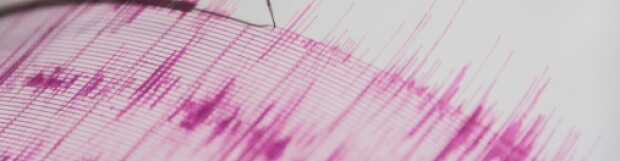